Mobile app that lets farmers consult parcel data and water management information
About the project
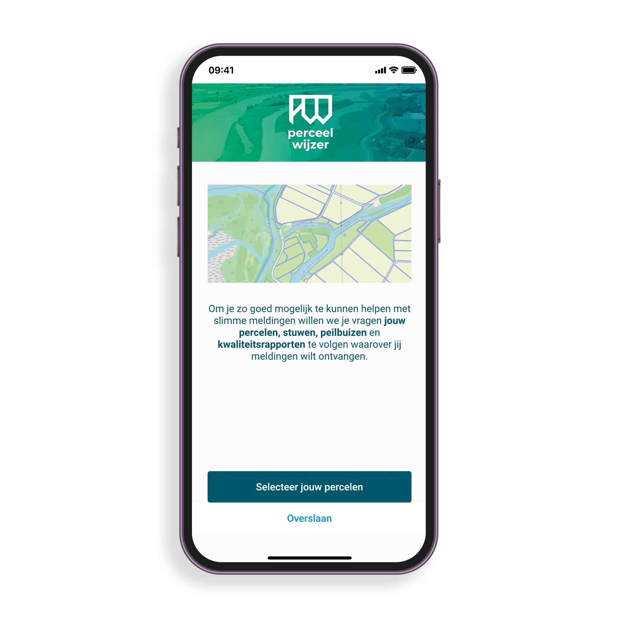
In the Netherlands, water management plays a crucial role. The Perceelwijzer app gives farmers direct answers in the field to questions such as "Can I irrigate my land?" or "When will the grass be mowed?". The app shows parcel boundaries, water levels, weirs and monitoring wells on an interactive map.
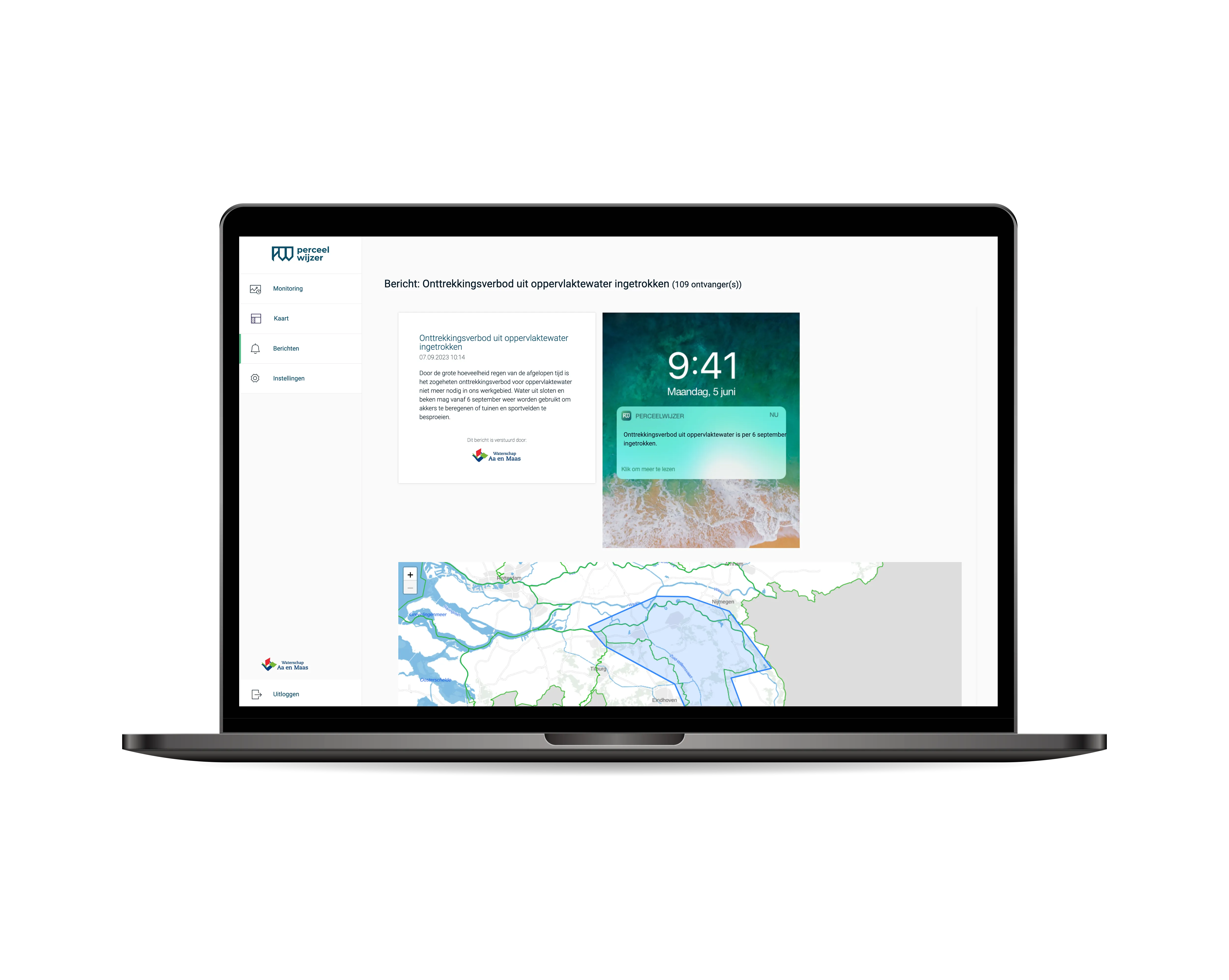
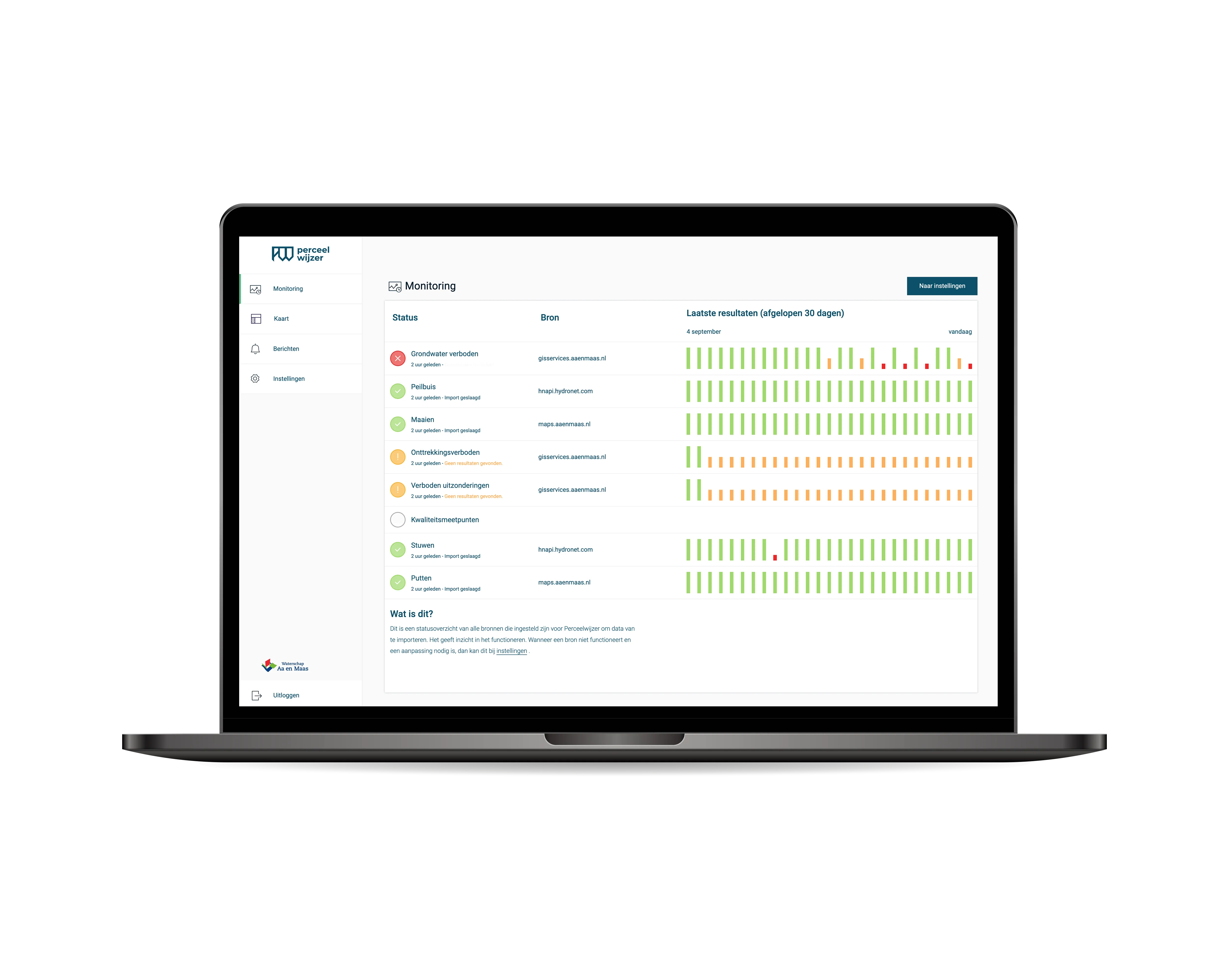
In addition to the app, The Next App also developed a management CMS that allows water authorities to centrally manage notifications and content. Currently five water authorities are connected: Brabantse Delta, Limburg, De Dommel, Aa en Maas and Rijn en IJssel.
Features

5
Water authorities connected, including Brabantse Delta, De Dommel and Rijn en IJssel
iOS & Android
One Flutter codebase for both platforms, including OTA updates
Real-time
GIS map layers and water management data directly accessible in the field
The challenge
Water authorities work with extensive geographic datasets that are difficult for farmers to consult. Het Waterschapshuis wanted an app that allows farmers to see directly in the field which rules and water management situations apply to their parcel.
The approach
We built a Flutter app with GIS map integration showing parcel boundaries, water levels, weirs and monitoring wells on an interactive map. Farmers can submit notifications directly from the app. A management CMS allows water authorities to centrally manage notifications and content.
Result
The solution: a Flutter app that gives farmers direct answers to questions about their parcel. Via GIS map layers, farmers can see parcel boundaries, water levels and relevant water management information in real time.
5
Water authorities connected: Brabantse Delta, Limburg, De Dommel, Aa en Maas and Rijn en IJssel
iOS & Android
Cross-platform from one Flutter codebase, including CMS for water authority managers
GIS
Real-time map layers with parcel boundaries, water levels, weirs and monitoring wells in the field
Working with The Next App?
Want to build a GIS app or map integration?
Technology
FAQ
Perceelwijzer is a mobile app that lets farmers consult parcel data and water management information directly in the field. The app answers questions such as "Can I irrigate my land?" and shows weirs, monitoring wells and water levels on an interactive map.
Currently five water authorities are connected to Perceelwijzer: Brabantse Delta, Limburg, De Dommel, Aa en Maas and Rijn en IJssel.
Yes. The Next App has experience integrating GIS map layers into mobile apps.
Let's grab a coffee. Tell us about your idea and we'll give you our honest take on what's possible.
Schedule a call →